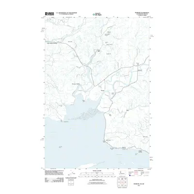
2011 Map of Rosburg
USGS Topo · Published 2011About this map
The Columbia River dominates the southern reaches of this landscape, where the tidal influence is evident in the intricate network of channels including Seal Slough and Halaya Slough. The riverside economy and maritime history are anchored by landings and lights, such as Carlson Landing, Svensens Landing, and the Rocky Point Light. Moving inland, the terrain transitions into a complex drainage system fed by the Grays River and Deep River, where small communities like Rosburg and Oneida are connected by local roads named for early area residents.
Find a feature on this map
74 named features on this map. Tap any name to fly to it.
Don’t see what you’re looking for? This feature index may not catch every label — zoom into the map to look around manually.
Map Details
Editions of this 2011 Rosburg Map
This is the sole edition of this map. No revisions or reprints were ever made.
Other maps of this area

1919 · Astoria
USGS Topo · 1:62,500

1938 · Fort Columbia
USGS Topo · 1:62,500

1939 · Astoria
USGS Topo · 1:62,500

1940 · Svensen
USGS Topo · 1:62,500

1940 · Brookfield
USGS Topo · 1:62,500

1943 · Fort Columbia
USGS Topo · 1:62,500

1949 · Astoria
USGS Topo · 1:24,000

1949 · Upper Naselle River
USGS Topo · 1:24,000

1949 · Oman Ranch
USGS Topo · 1:24,000

1949 · Knappton
USGS Topo · 1:24,000