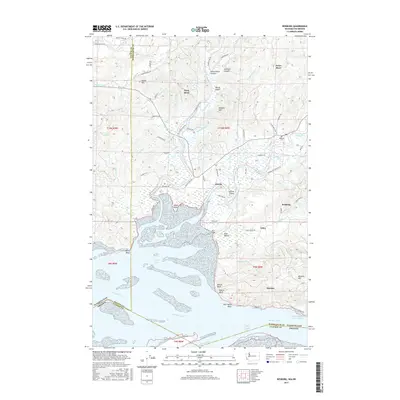
2017 Map of Rosburg
USGS Topo · Published 2017About this map
Rosburg and Altoona serve as the primary landward anchors for this coastal landscape where the Columbia River meets Grays Bay. The map reveals a complex network of estuarine sloughs and river channels, including the winding course of the Deep River and Grays River, which dictate the placement of roads like Altoona-Pillar Rock Rd. This area of Wahkiakum County is defined by its shoreline transitions, from the tidal flats near Miller Point to the prominent elevations of Yellow Bluff and Pigeon Bluff. Local history is preserved in the location of the Rosburg Cem and small settlements such as Oneida and Eden. The presence of the Pillar Rock Lower Range and Astoria Range signals the maritime importance of the river channel, which forms the state boundary between Washington and Oregon, connecting the timber-rich hills to the Pacific shipping lanes.
Find a feature on this map
80 named features on this map. Tap any name to fly to it.
Don’t see what you’re looking for? This feature index may not catch every label — zoom into the map to look around manually.
Map Details
Editions of this 2017 Rosburg Map
This is the sole edition of this map. No revisions or reprints were ever made.
Other maps of this area

1919 · Astoria
USGS Topo · 1:62,500

1938 · Fort Columbia
USGS Topo · 1:62,500

1939 · Astoria
USGS Topo · 1:62,500

1940 · Svensen
USGS Topo · 1:62,500

1940 · Brookfield
USGS Topo · 1:62,500

1943 · Fort Columbia
USGS Topo · 1:62,500

1949 · Astoria
USGS Topo · 1:24,000

1949 · Upper Naselle River
USGS Topo · 1:24,000

1949 · Oman Ranch
USGS Topo · 1:24,000

1949 · Knappton
USGS Topo · 1:24,000