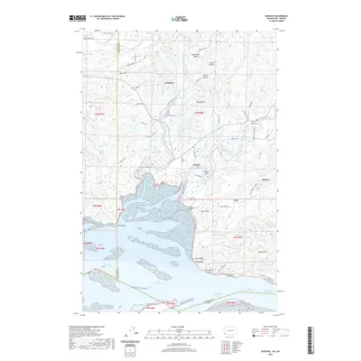
2020 Map of Rosburg
USGS Topo · Published 2020About this map
Grays Bay and the wide expanse of the Columbia River dominate the southern portion of this landscape, where the tidal influence of the Pacific reaches deep into the coastal hills of Wahkiakum County. The settlement patterns follow the winding paths of the Grays River, Deep River, and Naselle River, reflecting a community inextricably linked to the water. In the northern reaches, the terrain rises toward Salme Hill and is carved by several distinct canyons, including Hendrickson Canyon and Johnson Canyon.
Find a feature on this map
79 named features on this map. Tap any name to fly to it.
Don’t see what you’re looking for? This feature index may not catch every label — zoom into the map to look around manually.
Map Details
Editions of this 2020 Rosburg Map
This is the sole edition of this map. No revisions or reprints were ever made.
Other maps of this area

1919 · Astoria
USGS Topo · 1:62,500

1938 · Fort Columbia
USGS Topo · 1:62,500

1939 · Astoria
USGS Topo · 1:62,500

1940 · Svensen
USGS Topo · 1:62,500

1940 · Brookfield
USGS Topo · 1:62,500

1943 · Fort Columbia
USGS Topo · 1:62,500

1949 · Astoria
USGS Topo · 1:24,000

1949 · Upper Naselle River
USGS Topo · 1:24,000

1949 · Oman Ranch
USGS Topo · 1:24,000

1949 · Knappton
USGS Topo · 1:24,000