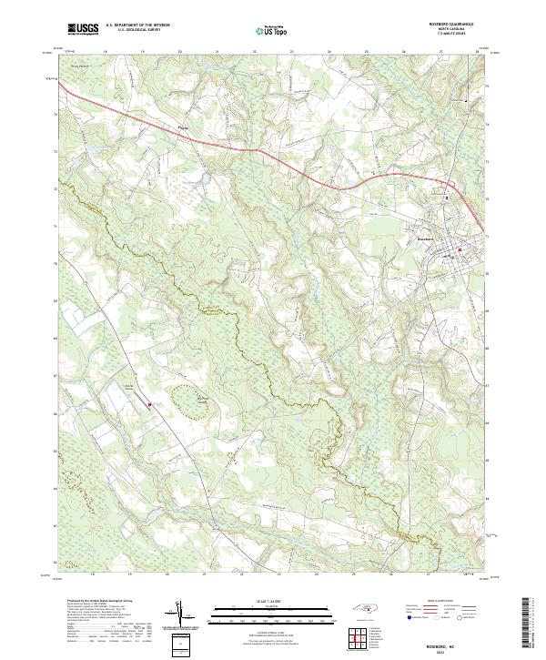
2022 Map of Roseboro
USGS Topo · Published 2022About this map
The South River forms a winding natural border between Sampson and Cumberland Counties, defining a landscape of dense wetlands and agricultural clearings. Near the town of Roseboro, the terrain transitions into complex water systems including Big Pond Swamp and the distinctively named Big White Bay and Piney Pocosin. These lowland features suggest a history of careful land management in a region defined by its hydrography, where settlements like Hayne and the local Brocks Airport are situated on the higher, drier ground between the river and Little Coharie Cr.
Find a feature on this map
93 named features on this map. Tap any name to fly to it.
Don’t see what you’re looking for? This feature index may not catch every label — zoom into the map to look around manually.
Map Details
Editions of this 2022 Roseboro Map
This is the sole edition of this map. No revisions or reprints were ever made.
Other maps of this area

1909 · Coharie
USGS Topo · 1:62,500

1953 · Florence
USGS Topo · 1:250,000

1953 · Raleigh
USGS Topo · 1:250,000

1954 · Florence
USGS Topo · 1:250,000

1954 · Raleigh
USGS Topo · 1:250,000

1959 · Roseboro
USGS Topo · 1:62,500

1959 · Garland
USGS Topo · 1:62,500

1974 · Salemburg
USGS Topo · 1:24,000
1974 · Stedman
USGS Topo · 1:24,000

1982 · Elizabethtown
USGS Topo · 1:100,000