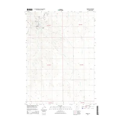
2015 Map of Rosebud
USGS Topo · Published 2015About this map
Rosebud and its surrounding prairie landscape are defined by the winding drainages of Rosebud Cr and its tributaries in this 2015 study. The settlement's street plan includes local history through names like N Spotted Tail Ln, Sitting Bear Ct, and Wasta Dr, providing specific geographic context for genealogists and researchers. Important community landmarks such as Spotted Tail Cem and Indian Scout Lake are clearly situated within the township boundaries. The area's hydrology is complex, featuring the W Br Rosebud Cr and E Br Rosebud Cr, which converge near Rosebud Lake. Rising above the watercourses, Rosebud Butte serves as a prominent navigational marker in the northeastern portion of the quadrangle, which also includes portions of the Soldier Cr watershed.
Find a feature on this map
37 named features on this map. Tap any name to fly to it.
Don’t see what you’re looking for? This feature index may not catch every label — zoom into the map to look around manually.
Map Details
Editions of this 2015 Rosebud Map
This is the sole edition of this map. No revisions or reprints were ever made.
Other maps of this area

1955 · Martin
USGS Topo · 1:250,000

1958 · Martin
USGS Topo · 1:250,000

1969 · Soldier Creek
USGS Topo · 1:24,000

1969 · Mission
USGS Topo · 1:24,000

1969 · Soldier Creek SE
USGS Topo · 1:24,000

1969 · Olsonville NW
USGS Topo · 1:24,000

1969 · Rosebud
USGS Topo · 1:24,000

1969 · St. Francis SW
USGS Topo · 1:24,000

1969 · Olsonville SW
USGS Topo · 1:24,000
1969 · St. Francis
USGS Topo · 1:24,000