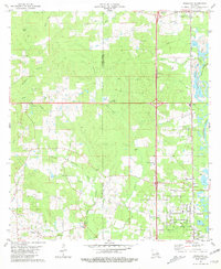
1981 Map of Roseland
USGS Topo · Published 1981About this map
The Tangipahoa River and the Illinois Central Gulf railroad define the north-south transit corridor of this Louisiana parish landscape. Small settlements like Fluker, Arcola, and Roseland are clustered along the rail line, while Interstate 55 runs parallel just to the west, representing the modernization of regional travel. The map is particularly rich in family and community history landmarks, including numerous small burial grounds such as Butler Temple Cem and Phillips Cem. In the west, the landscape is segmented by the St. Helena Parish and Tangipahoa Parish boundary, where many smaller tributaries like the West Natalbany River and Distillery Branch carve through the terrain. The presence of specialized features like the Fish Farm, Fluker Lookout Tower, and multiple Gravel Pits illustrates a local economy rooted in both the natural environment and resource extraction.
Find a feature on this map
51 named features on this map. Tap any name to fly to it.
Don’t see what you’re looking for? This feature index may not catch every label — zoom into the map to look around manually.
Map Details
Editions of this 1981 Roseland Map
2 editions found
Other maps of this area

1940 · Spring Creek
USGS Topo · 1:31,680

1940 · Roseland
USGS Topo · 1:31,680

1942 · Roseland
USGS Topo · 1:31,680

1942 · Montpelier
USGS Topo · 1:31,680

1942 · Liverpool
USGS Topo · 1:31,680

1942 · Loranger
USGS Topo · 1:31,680

1949 · Bolivar
USGS Topo · 1:31,680

1949 · Amite
USGS Topo · 1:31,680

1950 · Kentwood
USGS Topo · 1:31,680

1950 · Greensburg
USGS Topo · 1:31,680