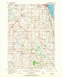
1956 Map of Rosendale
USGS Topo · Published 1972About this map
Winnebago Lake forms the eastern boundary of this mid-century landscape, where the shoreline developments of Stony Beach, Roe Point, and Paukotuk meet the agricultural heart of Winnebago and Fond du Lac Co. The map captures a high density of rural institutions, particularly small schools like Boxelder Line Sch and High Ridge Sch, reflecting the community structure before widespread district consolidation.
Find a feature on this map
106 named features on this map. Tap any name to fly to it.
Don’t see what you’re looking for? This feature index may not catch every label — zoom into the map to look around manually.
Map Details
Editions of this 1956 Rosendale Map
2 editions found

Other maps of this area

1910 · Fond du Lac
USGS Topo · 1:62,500

1911 · Neenah
USGS Topo · 1:62,500

1916 · Ripon
USGS Topo · 1:48,000

1918 · Ripon
USGS Topo · 1:62,500

1955 · Neenah
USGS Topo · 1:62,500

1955 · Waupun
USGS Topo · 1:62,500

1955 · Campbellsport
USGS Topo · 1:62,500

1955 · Fox Lake
USGS Topo · 1:62,500

1955 · Fond Du Lac
USGS Topo · 1:62,500

1955 · Fond Du Lac
USGS Topo · 1:24,000