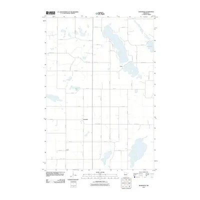
2010 Map of Rosendale
USGS Topo · Published 2010About this map
Acton and Rosendale anchor this part of Meeker County, showing a landscape defined by traditional section-line roads and glaciated water features. The map illustrates a rural interior where agricultural life is organized around a grid of thoroughfares including County Hwy-23 and County Hwy-28. Local landmarks such as the Immanuel Cemetery and the shores of Thoen Lake provide specific points of interest for those researching family ties to the area.
Find a feature on this map
23 named features on this map. Tap any name to fly to it.
Don’t see what you’re looking for? This feature index may not catch every label — zoom into the map to look around manually.
Map Details
Editions of this 2010 Rosendale Map
This is the sole edition of this map. No revisions or reprints were ever made.
Other maps of this area

1953 · New Ulm
USGS Topo · 1:250,000

1953 · Saint Cloud
USGS Topo · 1:250,000

1956 · Atwater
USGS Topo · 1:62,500

1957 · Saint Cloud
USGS Topo · 1:250,000

1957 · New Ulm
USGS Topo · 1:250,000

1957 · Olivia
USGS Topo · 1:62,500

1958 · New Ulm
USGS Topo · 1:250,000

1958 · Saint Cloud
USGS Topo · 1:250,000

1967 · New Ulm
USGS Topo · 1:250,000

1967 · Grove City
USGS Topo · 1:24,000