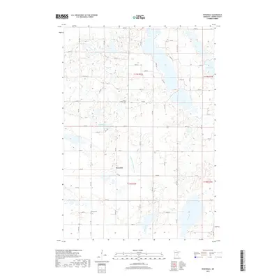
2019 Map of Rosendale
USGS Topo · Published 2019About this map
Rosendale stands at the center of this rural Meeker County landscape, defined by its intricate network of lakes and agricultural drainages. The area is marked by numerous glacial water bodies, including Popple Lake, Kelley Lake, and Doxton Lake, which are interconnected by engineered waterways such as County Ditch Number Sixteen. This mapping captures the community's local history through well-preserved sites like the Arndahl Lutheran Cem and Immanuel Cem, reflecting the enduring presence of early Lutheran and immigrant settlements in central Minnesota. The terrain is further etched by the winding paths of King Creek and Belle Creek, which flow through the sections of Acton and Danielson townships. The grid of county roads, including Co Rd 28 and Co St Aid Hwy 32, reveals a traditional Midwestern settlement pattern where family farms were oriented around these vital water sources and community centers.
Find a feature on this map
41 named features on this map. Tap any name to fly to it.
Don’t see what you’re looking for? This feature index may not catch every label — zoom into the map to look around manually.
Map Details
Editions of this 2019 Rosendale Map
This is the sole edition of this map. No revisions or reprints were ever made.
Other maps of this area

1953 · New Ulm
USGS Topo · 1:250,000

1953 · Saint Cloud
USGS Topo · 1:250,000

1956 · Atwater
USGS Topo · 1:62,500

1957 · Saint Cloud
USGS Topo · 1:250,000

1957 · New Ulm
USGS Topo · 1:250,000

1957 · Olivia
USGS Topo · 1:62,500

1958 · New Ulm
USGS Topo · 1:250,000

1958 · Saint Cloud
USGS Topo · 1:250,000

1967 · New Ulm
USGS Topo · 1:250,000

1967 · Grove City
USGS Topo · 1:24,000