
1959 Map of Rosewood
USGS Topo · Published 1960About this map
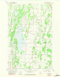
The Minnesota prairie landscape of the late 1950s is defined by the sharp diagonal passage of the Minneapolis St Paul and Sault Ste Marie railroad. This rail line anchors the small settlement of Rosewood, which serves as a central hub for the surrounding townships of New Solum, King, Numedal, and Norden. The map reveals a community structured around rural cornerstones, such as the Town Hall and local worship centers like Rindal Ch and Oak Ridge Ch.
Find a feature on this map
15 named features on this map. Tap any name to fly to it.
Don’t see what you’re looking for? This feature index may not catch every label — zoom into the map to look around manually.
Map Details
Editions of this 1959 Rosewood Map
2 editions found
Other maps of this area

1918 · Viking
USGS Topo · 1:62,500

1918 · Middle River
USGS Topo · 1:62,500

1943 · Thief River Falls
USGS Topo · 1:62,500

1952 · Thief River Falls
USGS Topo · 1:250,000

1956 · Thief River Falls
USGS Topo · 1:250,000

1957 · Thief River Falls
USGS Topo · 1:250,000

1957 · Newfolden
USGS Topo · 1:62,500

1959 · Viking
USGS Topo · 1:24,000
1959 · Viking SW
USGS Topo · 1:24,000
1959 · Thief River Falls
USGS Topo · 1:24,000