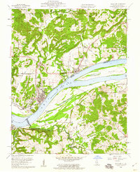
1959 Map of Rosiclare
USGS Topo · Published 1960About this map
The Ohio River dominates this mid-century landscape at the border of Illinois and Kentucky, where the river-based economy and extensive mining operations define the region's character. In the town of Rosiclare, a concentrated network of extraction sites including the Rosiclare Mine, Ozark Mahoning Mine, and Alcoa Mine are visible, complete with their associated tailings ponds. This industrial presence contrasts with the northern portion of the map, which is largely occupied by the Shawnee National Forest and characterized by high points like Keeling Hill.
Find a feature on this map
48 named features on this map. Tap any name to fly to it.
Don’t see what you’re looking for? This feature index may not catch every label — zoom into the map to look around manually.
Map Details
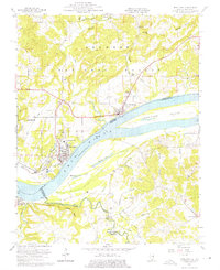
Editions of this 1959 Rosiclare Map
2 editions found
Other maps of this area

1916 · Shawneetown
USGS Topo · 1:62,500

1916 · Fords Ferry
USGS Topo · 1:62,500

1916 · Golconda
USGS Topo · 1:62,500

1916 · Equality
USGS Topo · 1:62,500

1920 · Goloonda
USGS Topo · 1:48,000

1921 · Fords Ferry
USGS Topo · 1:48,000

1921 · Golconda
USGS Topo · 1:62,500

1925 · Cave In Rock
USGS Topo · 1:62,500

1949 · Paducah
USGS Topo · 1:250,000

1950 · Paducah
USGS Topo · 1:250,000