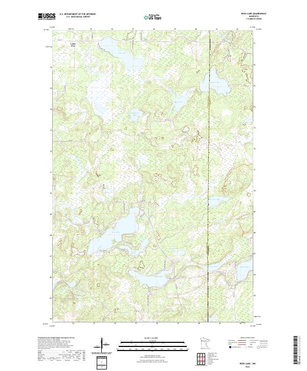
2022 Map of Ross Lake
USGS Topo · Published 2022About this map
Stark Lake and Ross Lake dominate this landscape along the boundary of Crow Wing and Aitkin counties. This region is defined by an intricate network of glacial wetlands and water bodies, where drainage systems like Ross Brook and Mud Brook connect isolated basins such as Lows Lake and Snodgrass Lake. The presence of Blind Lake Trail and the Blind Lake Connector Trail suggests a landscape managed for recreational use and forestry, a common pattern in this part of Minnesota. The map reveals the layout of rural access through named routes like County Road 36 and County Highway 1, which serve small residential clusters and seasonal cabins near the shores of Coon Lake and Thompson Lake. This detailed view of the t137n r25w and t48n r27w townships provides a precise record of the shoreline geometry and wetland boundaries as they existed in the early 21st century.
Find a feature on this map
62 named features on this map. Tap any name to fly to it.
Don’t see what you’re looking for? This feature index may not catch every label — zoom into the map to look around manually.
Map Details
Editions of this 2022 Ross Lake Map
This is the sole edition of this map. No revisions or reprints were ever made.
Other maps of this area

1913 · Cuyuna
USGS Topo · 1:62,500

1914 · Aitkin
USGS Topo · 1:62,500

1915 · Aitkin
USGS Topo · 1:62,500

1915 · Cuyuna
USGS Topo · 1:62,500

1953 · Duluth
USGS Topo · 1:250,000

1958 · Duluth
USGS Topo · 1:250,000

1970 · Edna Lake
USGS Topo · 1:24,000
1970 · Roosevelt Lake
USGS Topo · 1:24,000

1970 · White Elk Lake
USGS Topo · 1:24,000
1973 · Emily
USGS Topo · 1:24,000