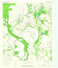
1963 Map of Rosser
USGS Topo · Published 1966About this map
The confluence of the East Fork Trinity River and the Trinity River dominates this mid-century landscape in Kaufman County. The settlement of Rosser sits at a geographic pivot point, surrounded by evidence of early 20th-century engineering attempts to navigate and control the river, including Lock No 7 and the remnants of an Old Grade Railroad. The terrain is defined by a complex network of wetlands and seasonal water bodies such as Ezell Slough, Cutoff Slough, and Deadman Slough, which weave through the river bottoms.
Find a feature on this map
35 named features on this map. Tap any name to fly to it.
Don’t see what you’re looking for? This feature index may not catch every label — zoom into the map to look around manually.
Map Details
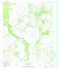
Editions of this 1963 Rosser Map
2 editions found
Other maps of this area

1891 · Dallas
USGS Topo · 1:125,000

1893 · Dallas
USGS Topo · 1:125,000

1954 · Dallas
USGS Topo · 1:250,000

1956 · Ennis
USGS Topo · 1:62,500

1956 · Kaufman
USGS Topo · 1:62,500

1958 · Dallas
USGS Topo · 1:250,000

1959 · India
USGS Topo · 1:24,000

1959 · Seagoville
USGS Topo · 1:62,500

1960 · Grays Prairie
USGS Topo · 1:24,000

1962 · Ennis East
USGS Topo · 1:24,000