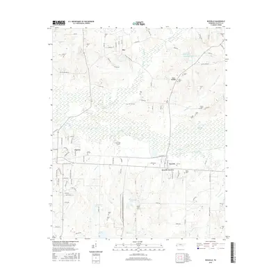
2016 Map of Rossville
USGS Topo · Published 2016About this map
The Wolf River corridor defines the landscape of south-central Fayette County, where the bottomlands separate the communities of Piperton and Rossville. This survey illustrates the intricate drainage network of the region, featuring Running Slough and several named water bodies such as Lily Lake and the sequential Keith Lake One, Keith Lake Number Two, and Keith Lake Number Three. The presence of the Wolf River Airport south of the river suggests the continued importance of regional aviation infrastructure. Genealogy researchers will find significant data in the distribution of family-named burial grounds across the rural terrain, including the Thomas Chapel Cem, Farley Cem, and Oursler Cem. The map also captures small rural centers like Elba and New Bethel, connected by a network of local roads such as Raleigh Lagrange Dr and Morrison Rd.
Find a feature on this map
99 named features on this map. Tap any name to fly to it.
Don’t see what you’re looking for? This feature index may not catch every label — zoom into the map to look around manually.
Map Details
Editions of this 2016 Rossville Map
This is the sole edition of this map. No revisions or reprints were ever made.
Other maps of this area

1943 · Collierville
USGS Topo · 1:62,500

1948 · Byhalia
USGS Topo · 1:62,500

1949 · Moscow
USGS Topo · 1:62,500

1953 · Holly Springs
USGS Topo · 1:62,500

1953 · Collierville
USGS Topo · 1:50,000

1956 · Blytheville
USGS Topo · 1:250,000

1956 · Tupelo
USGS Topo · 1:250,000

1958 · Tupelo
USGS Topo · 1:250,000

1959 · Blytheville
USGS Topo · 1:250,000

1965 · Rossville
USGS Topo · 1:24,000