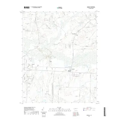
2019 Map of Rossville
USGS Topo · Published 2019About this map
Rossville and its neighbor Rossville Junction anchor this part of Fayette County, where the landscape transitions from the residential developments of Piperton into the wetlands and sloughs of the Wolf River valley. The map documents a territory defined by its water, with numerous small lakes and named drainages such as Running Slough, Alexander Cr, and Hurricane Cr winding through the terrain. Evidence of long-standing community roots is found in the dense distribution of family and church burial grounds, including New Bethel Cem, Teel Cem, and Mount Vernon Cem. The presence of the Wolf River Airport and several modern lake developments like Keith Lake Number Two and Keith Lake Number Three illustrate the area's continued evolution from its agrarian origins. This survey provides a look at the rural and suburban intersection of West Tennessee as it appeared in the late 2010s.
Find a feature on this map
104 named features on this map. Tap any name to fly to it.
Don’t see what you’re looking for? This feature index may not catch every label — zoom into the map to look around manually.
Map Details
Editions of this 2019 Rossville Map
This is the sole edition of this map. No revisions or reprints were ever made.
Other maps of this area

1943 · Collierville
USGS Topo · 1:62,500

1948 · Byhalia
USGS Topo · 1:62,500

1949 · Moscow
USGS Topo · 1:62,500

1953 · Holly Springs
USGS Topo · 1:62,500

1953 · Collierville
USGS Topo · 1:50,000

1956 · Blytheville
USGS Topo · 1:250,000

1956 · Tupelo
USGS Topo · 1:250,000

1958 · Tupelo
USGS Topo · 1:250,000

1959 · Blytheville
USGS Topo · 1:250,000

1965 · Rossville
USGS Topo · 1:24,000