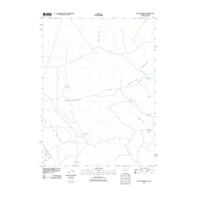
2010 Map of Rotten Springs
USGS Topo · Published 2010About this map
The high desert landscape of Powder Rim dominates this survey, where livestock management and historical transit routes intersect in southern Wyoming. The persistence of open-range ranching is evidenced by the Shell Creek Stock Trl and various water catchments such as Short Wash Reservoir and Hunter Reservoir, which provide essential resources in a semi-arid environment. Human presence is concentrated around specific water sources, notably at the M F S Homestead and near Rotten Springs. This region is also shaped by drainage patterns like Reader Cabin Draw and Cherokee Draw, which cut through the Cherokee Basin toward the state line. The Cherokee Trail Rd follows the natural contours of the rim, tracing a legacy of movement through this segment of Sweetwater County.
Find a feature on this map
25 named features on this map. Tap any name to fly to it.
Don’t see what you’re looking for? This feature index may not catch every label — zoom into the map to look around manually.
Map Details
Editions of this 2010 Rotten Springs Map
This is the sole edition of this map. No revisions or reprints were ever made.
Other maps of this area

1916 · Craig
USGS Topo · 1:125,000

1954 · Vernal
USGS Topo · 1:250,000

1954 · Rawlins
USGS Topo · 1:250,000

1954 · Rock Springs
USGS Topo · 1:250,000

1954 · Craig
USGS Topo · 1:250,000

1957 · Craig
USGS Topo · 1:250,000

1958 · Rawlins
USGS Topo · 1:250,000

1958 · Vernal
USGS Topo · 1:250,000

1958 · Rock Springs
USGS Topo · 1:250,000

1958 · Craig
USGS Topo · 1:250,000