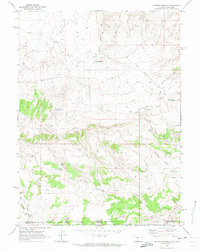
1970 Map of Rotten Springs
USGS Topo · Published 1973About this map
Powder Rim dominates this high-desert landscape along the Wyoming and Colorado border, a massive geologic feature that dictated the paths of early travel. The historical Cherokee Trail Road skirts the base of these cliffs, following a route used by emigrants and travelers through this arid territory. Evidence of 20th-century land use is seen in the numerous small reservoirs and improvements designed to capture scarce water, such as Hunter Res and Flat Draw Res.
Find a feature on this map
31 named features on this map. Tap any name to fly to it.
Don’t see what you’re looking for? This feature index may not catch every label — zoom into the map to look around manually.
Map Details
Editions of this 1970 Rotten Springs Map
This is the sole edition of this map. No revisions or reprints were ever made.
Other maps of this area

1916 · Craig
USGS Topo · 1:125,000

1954 · Vernal
USGS Topo · 1:250,000

1954 · Rawlins
USGS Topo · 1:250,000

1954 · Rock Springs
USGS Topo · 1:250,000

1954 · Craig
USGS Topo · 1:250,000

1957 · Craig
USGS Topo · 1:250,000

1958 · Rawlins
USGS Topo · 1:250,000

1958 · Vernal
USGS Topo · 1:250,000

1958 · Rock Springs
USGS Topo · 1:250,000

1958 · Craig
USGS Topo · 1:250,000