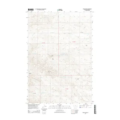
2014 Map of Rough Draw
USGS Topo · Published 2014About this map
The Little Wolf Mountains dominate the southwestern corner of this Rosebud County landscape, giving way to a network of drainage systems that define the area's geography. Flowing eastward, the W Fork Armells Cr and E Fork Armells Cr carve through the high plains, joined by named topographic features like Lee Coulee and Richard Coulee. This 2014 survey reveals a territory primarily shaped by its hydrology and terrain, where access is limited to thoroughfares such as Farley Rd and Farley Loop Rd.
Find a feature on this map
24 named features on this map. Tap any name to fly to it.
Don’t see what you’re looking for? This feature index may not catch every label — zoom into the map to look around manually.
Map Details
Editions of this 2014 Rough Draw Map
This is the sole edition of this map. No revisions or reprints were ever made.
Other maps of this area

1954 · Hardin
USGS Topo · 1:250,000

1957 · Hardin
USGS Topo · 1:250,000

1958 · Hardin
USGS Topo · 1:250,000

1958 · Chalky Point
USGS Topo · 1:24,000

1958 · Jimtown
USGS Topo · 1:24,000

1958 · Black Spring
USGS Topo · 1:24,000

1971 · Trail Creek School
USGS Topo · 1:24,000

1971 · Colstrip SW
USGS Topo · 1:24,000

1971 · Mc Clure Creek
USGS Topo · 1:24,000

1971 · Rough Draw
USGS Topo · 1:24,000