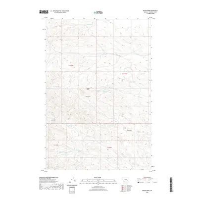
2020 Map of Rough Draw
USGS Topo · Published 2020About this map
The Little Wolf Mountains dominate the western portion of this 2020 landscape, where the high ridges of Rosebud County give way to a network of deeply etched coulees and ephemeral creek beds. The drainage pattern is a defining characteristic of this terrain, with the E Fork Armells Cr and W Fork Armells Cr cutting through the northern sections, while Slough Grass Cr winds through the south. This is an area of significant elevation changes and natural springs, many of which are specifically cataloged by their public land survey coordinates. The map captures the specialized local nomenclature of the high plains, where features like Richard Coulee, Lee Coulee, and Rape Coulee serve as primary landmarks in a region largely devoid of traditional town centers. Near the center, Rough Draw provides a focal point for the complex topography that defines this part of Montana.
Find a feature on this map
24 named features on this map. Tap any name to fly to it.
Don’t see what you’re looking for? This feature index may not catch every label — zoom into the map to look around manually.
Map Details
Editions of this 2020 Rough Draw Map
This is the sole edition of this map. No revisions or reprints were ever made.
Other maps of this area

1954 · Hardin
USGS Topo · 1:250,000

1957 · Hardin
USGS Topo · 1:250,000

1958 · Hardin
USGS Topo · 1:250,000

1958 · Chalky Point
USGS Topo · 1:24,000

1958 · Jimtown
USGS Topo · 1:24,000

1958 · Black Spring
USGS Topo · 1:24,000

1971 · Trail Creek School
USGS Topo · 1:24,000

1971 · Colstrip SW
USGS Topo · 1:24,000

1971 · Mc Clure Creek
USGS Topo · 1:24,000

1971 · Rough Draw
USGS Topo · 1:24,000