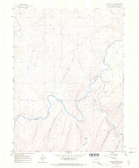
1966 Map of Round Bottom
USGS Topo · Published 1970About this map
The Yampa River carves a winding path through this corner of Moffat County, creating the distinct lowlands of Round Bottom and Big Bottom. This mid-1960s survey documents a landscape defined by the confluence with the Williams Fork and the transition from river valleys to high points like Iles Mountain and the Williams Fork Mountains.
Find a feature on this map
24 named features on this map. Tap any name to fly to it.
Don’t see what you’re looking for? This feature index may not catch every label — zoom into the map to look around manually.
Map Details
Editions of this 1966 Round Bottom Map
3 editions found
Other maps of this area

1910 · Danforth Hills
USGS Topo · 1:125,000

1912 · Axial
USGS Topo · 1:62,500

1914 · Axial
USGS Topo · 1:62,500

1915 · Monument Butte
USGS Topo · 1:62,500

1916 · Craig
USGS Topo · 1:125,000

1954 · Craig
USGS Topo · 1:250,000

1957 · Craig
USGS Topo · 1:250,000

1958 · Craig
USGS Topo · 1:250,000

1960 · Craig
USGS Topo · 1:250,000

1962 · Craig
USGS Topo · 1:250,000