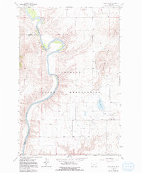
1965 Map of Round Butte
USGS Topo · Published 1992About this map
The Flathead Indian Reservation defines this region of western Montana, where the powerful Flathead River snakes through the landscape, forming the boundary between Lake and Sanders Counties. This 1965 field survey captures an era of extensive agricultural irrigation, evidenced by the dense network of waterways including the Pablo Canal, Pablo Ditch, and Pablo 13 A Canal. The terrain is marked by the prominent Valley View Hills to the east and the namesake Round Butte landmark near the intersection of these vital water systems. The map illustrates a rural economy reliant on water management, featuring several man-made improvements such as the Horte Reservoir and a local Gravel Pit, providing a detailed look at the infrastructure supporting the valley's development during the mid-20th century.
Find a feature on this map
12 named features on this map. Tap any name to fly to it.
Don’t see what you’re looking for? This feature index may not catch every label — zoom into the map to look around manually.
Map Details
Editions of this 1965 Round Butte Map
2 editions found
Other maps of this area

1920 · Flathead Lake
USGS Topo · 1:125,000

1956 · Wallace
USGS Topo · 1:250,000

1960 · Wallace
USGS Topo · 1:250,000

1964 · Buffalo Bridge
USGS Topo · 1:24,000

1964 · Melton Ranch
USGS Topo · 1:24,000

1964 · Polson
USGS Topo · 1:24,000

1964 · Lower Crow Reservoir
USGS Topo · 1:24,000

1965 · Sloan
USGS Topo · 1:24,000

1965 · Oliver Point
USGS Topo · 1:24,000
1965 · Irvine Hill
USGS Topo · 1:24,000