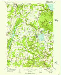
1954 Map of Round Lake
USGS Topo · Published 1956About this map
Ballston Lake and Round Lake anchor this mid-century portrait of southern Saratoga County, showing a landscape defined by its glacial hydrology and the vital corridor of the Delaware and Hudson RR. The map captures the quiet growth of Jonesville, Elnora, and Maltaville before the massive suburban expansion of later decades. An interesting military footprint is visible at the US Military Res (Malta Test Sta) near Malta Ridge, pointing to the area's role in Cold War-era technological development.
Find a feature on this map
72 named features on this map. Tap any name to fly to it.
Don’t see what you’re looking for? This feature index may not catch every label — zoom into the map to look around manually.
Map Details
Editions of this 1954 Round Lake Map
3 editions found
Other maps of this area

1893 · Cohoes
USGS Topo · 1:62,500

1893 · Schenectady
USGS Topo · 1:62,500

1895 · Cohoes
USGS Topo · 1:62,500

1895 · Schenectady
USGS Topo · 1:62,500

1898 · Schenectady
USGS Topo · 1:62,500

1898 · Cohoes
USGS Topo · 1:62,500

1900 · Schuylerville
USGS Topo · 1:62,500

1902 · Saratoga
USGS Topo · 1:62,500

1929 · Cohoes
USGS Topo · 1:62,500

1930 · Schenectady
USGS Topo · 1:62,500