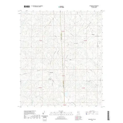
2020 Map of Rounsaville
USGS Topo · Published 2020About this map
The boundary between Mississippi and Alabama defines the eastern landscape of this quadrangle, where the settlements of Rounsaville and Walley anchor a terrain of dense creeks and family-named roads. For genealogists and local historians, several small burial sites are preserved, including the Rounsaville Hyatt Memorial Cemetery and the Old Burbank Cemetery near the community of Burbank.
Find a feature on this map
61 named features on this map. Tap any name to fly to it.
Don’t see what you’re looking for? This feature index may not catch every label — zoom into the map to look around manually.
Map Details
Editions of this 2020 Rounsaville Map
This is the sole edition of this map. No revisions or reprints were ever made.
Other maps of this area

1942 · Deer Park
USGS Topo · 1:62,500

1943 · Deer Park
USGS Topo · 1:62,500

1953 · Hattiesburg
USGS Topo · 1:250,000

1958 · Hattiesburg
USGS Topo · 1:250,000

1964 · Clark
USGS Topo · 1:24,000

1972 · Leakesville
USGS Topo · 1:24,000
1972 · Vernal
USGS Topo · 1:24,000

1974 · Fruitdale
USGS Topo · 1:24,000

1974 · Vinegar Bend
USGS Topo · 1:24,000
1982 · Citronelle West
USGS Topo · 1:24,000