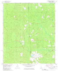
1982 Map of Rounsaville
USGS Topo · Published 1982About this map
Rounsaville sits at the heart of this landscape, positioned where the hills of eastern Mississippi meet the border of Alabama. The geography of the late 1970s is defined by a dense network of watercourses, including Okwakee Creek and Green Creek, which drain the timbered uplands into wetlands like Martins Swamp. Evidence of past industry and transport is visible in the Old Railroad Grade that cuts across the terrain, reflecting the area's history of logging or early transit before modern road improvements took hold.
Find a feature on this map
30 named features on this map. Tap any name to fly to it.
Don’t see what you’re looking for? This feature index may not catch every label — zoom into the map to look around manually.
Map Details
Editions of this 1982 Rounsaville Map
This is the sole edition of this map. No revisions or reprints were ever made.
Other maps of this area

1942 · Deer Park
USGS Topo · 1:62,500

1943 · Deer Park
USGS Topo · 1:62,500

1953 · Hattiesburg
USGS Topo · 1:250,000

1958 · Hattiesburg
USGS Topo · 1:250,000

1964 · Clark
USGS Topo · 1:24,000

1972 · Leakesville
USGS Topo · 1:24,000
1972 · Vernal
USGS Topo · 1:24,000

1974 · Fruitdale
USGS Topo · 1:24,000

1974 · Vinegar Bend
USGS Topo · 1:24,000
1982 · Citronelle West
USGS Topo · 1:24,000