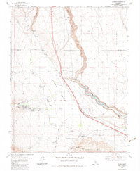
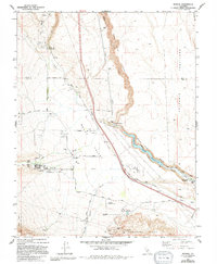
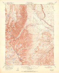
1983 Map of Rovana
USGS Topo · Published 1983About this map
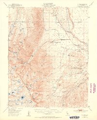
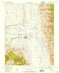
Tungsten Hills anchor the southern reaches of this landscape, where mining operations like the Western Mine, Round Valley Mine, and Little Shot Mine underscore the area's industrial history. The settlement of Rovana is situated near the confluence of Pine Creek and Mill Creek, while the broader Round Valley is dotted with landmarks such as the Round Valley School and the community of Alta Vista.
Find a feature on this map
54 named features on this map. Tap any name to fly to it.
Don’t see what you’re looking for? This feature index may not catch every label — zoom into the map to look around manually.
Map Details
Editions of this 1983 Rovana Map
2 editions found
Other maps of this area

1912 · Mt. Goddard
USGS Topo · 1:125,000

1913 · Bishop
USGS Topo · 1:125,000

1914 · Mt. Morrison
USGS Topo · 1:125,000

1917 · White Mountain
USGS Topo · 1:125,000

1947 · Mariposa
USGS Topo · 1:250,000

1948 · Mariposa
USGS Topo · 1:250,000
1949 · Mt. Tom
USGS Topo · 1:62,500
1949 · Bishop
USGS Topo · 1:62,500
1951 · Mt. Tom
USGS Topo · 1:62,500
1951 · Bishop
USGS Topo · 1:62,500