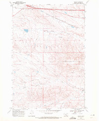
1969 Map of Rowley
USGS Topo · Published 1972About this map
Burlington Northern rail lines and modern interstate infrastructure meet in this portion of the Montana landscape, centered around the Crow Indian Reservation Boundary. The small settlements of Toluca and Rowley serve as focal points for the region's transport and sparse residential development during the late 1960s. The northern edge is dominated by the Toluca Interchange, while the southern portion of the map transitions into the drainage systems of the North Fork, Middle Fork, and South Fork.
Find a feature on this map
16 named features on this map. Tap any name to fly to it.
Don’t see what you’re looking for? This feature index may not catch every label — zoom into the map to look around manually.
Map Details
Editions of this 1969 Rowley Map
This is the sole edition of this map. No revisions or reprints were ever made.
Other maps of this area

1894 · Fort Custer
USGS Topo · 1:125,000

1954 · Hardin
USGS Topo · 1:250,000

1957 · Hardin
USGS Topo · 1:250,000

1958 · Hardin
USGS Topo · 1:250,000

1960 · Chimney Creek
USGS Topo · 1:24,000

1960 · Walker Hill
USGS Topo · 1:24,000

1960 · Hardin SW
USGS Topo · 1:24,000
1969 · Rowley NW
USGS Topo · 1:24,000
1969 · Bentonite Flats
USGS Topo · 1:24,000
1969 · Corinth
USGS Topo · 1:24,000