
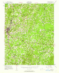
1943 Map of Roxboro
USGS Topo · Published 1956About this map
Roxboro serves as the primary hub of this 1943 survey, showing a landscape defined by small agrarian settlements and an extensive network of country schools and churches. The industrial presence of Longhurst and the transit corridor of the Norfolk and Western railroad indicate the economic drivers of the era, while the southeastern corner of the map is dominated by the Camp Butner Military Reservation, reflecting the region's wartime mobilization.
Find a feature on this map
50 named features on this map. Tap any name to fly to it.
Don’t see what you’re looking for? This feature index may not catch every label — zoom into the map to look around manually.
Map Details
Editions of this 1943 Roxboro Map
2 editions found
Other maps of this area

1941 · Clarksville
USGS Topo · 1:48,000

1943 · Clarksville
USGS Topo · 1:62,500

1943 · Creedmoor
USGS Topo · 1:62,500

1944 · Creedmoor
USGS Topo · 1:62,500

1951 · Durham North
USGS Topo · 1:62,500

1952 · Milton
USGS Topo · 1:62,500

1953 · Oxford
USGS Topo · 1:62,500

1953 · South Boston
USGS Topo · 1:62,500

1953 · Greensboro
USGS Topo · 1:250,000

1954 · Greensboro
USGS Topo · 1:250,000