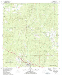
1988 Map of Roxie
USGS Topo · Published 1988About this map
Roxie serves as the primary hub in this late-twentieth-century study of the southwest Mississippi timberlands. The landscape is defined by the headwaters of Morgan Fork and Coles Creek as they weave through the northern reaches of the Homochitto National Forest. Historical transport patterns are visible in the Old Railroad Grade that connects the settlement of Hamburg to the surrounding forest, reflecting the region's long reliance on rail for the timber trade.
Find a feature on this map
34 named features on this map. Tap any name to fly to it.
Don’t see what you’re looking for? This feature index may not catch every label — zoom into the map to look around manually.
Map Details
Editions of this 1988 Roxie Map
This is the sole edition of this map. No revisions or reprints were ever made.
Other maps of this area

1953 · Natchez
USGS Topo · 1:250,000

1956 · Natchez
USGS Topo · 1:250,000

1959 · Natchez
USGS Topo · 1:250,000

1961 · Crosby
USGS Topo · 1:62,500

1962 · Fayette
USGS Topo · 1:62,500

1962 · Bude
USGS Topo · 1:62,500

1963 · Union Church
USGS Topo · 1:62,500
1984 · Natchez
USGS Topo · 1:100,000

1984 · Brookhaven
USGS Topo · 1:100,000

1984 · McComb
USGS Topo · 1:100,000