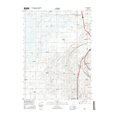
2017 Map of Roy
USGS Topo · Published 2017About this map
The Weber River winds through the northeastern corner of this landscape, marking a transition from the industrial outskirts of Ogden and Riverdale to the dense residential and commercial grids of the northern Wasatch Front. This 2017 survey details a highly developed corridor where established cities like Roy, Clinton, and Clearfield merge into a continuous suburban fabric. Significant local infrastructure is evident, notably the sprawling grounds of the Ogden-Hinckley Airport and the educational hub at Stevens-Henager Coll - Ogden.
Find a feature on this map
150 named features on this map. Tap any name to fly to it.
Don’t see what you’re looking for? This feature index may not catch every label — zoom into the map to look around manually.
Map Details
Editions of this 2017 Roy Map
This is the sole edition of this map. No revisions or reprints were ever made.
Other maps of this area

1954 · Antelope Island North
USGS Topo · 1:24,000

1954 · Ogden
USGS Topo · 1:250,000

1954 · Brigham City
USGS Topo · 1:250,000

1955 · Ogden
USGS Topo · 1:24,000

1955 · Plain City
USGS Topo · 1:24,000

1955 · Clearfield
USGS Topo · 1:24,000

1955 · Roy
USGS Topo · 1:24,000

1955 · Plain City SW
USGS Topo · 1:24,000

1955 · North Ogden
USGS Topo · 1:24,000

1955 · Kaysville
USGS Topo · 1:24,000