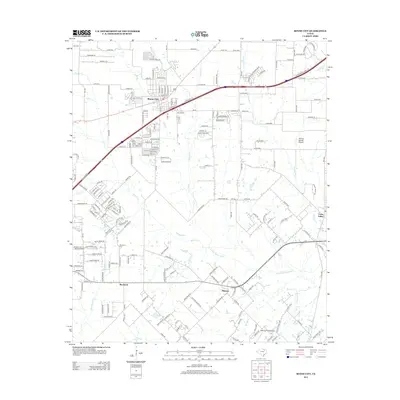
2012 Map of Royse City
USGS Topo · Published 2012About this map
Royse City serves as the primary hub of activity in this north Texas landscape, where the expansion of modern infrastructure meets a traditional agricultural and ranching layout. The path of Interstate 30 cuts diagonally through the terrain, contrasting with the winding courses of Sabine Cr and Parker Cr. To the south, the smaller communities of Blackland and Munson remain distinct, with the Blackland Cem providing a grounded point for genealogical interest. The geography is defined by the drainage systems of the S Fork Sabine River and its various tributaries like Renfro Cr and Bois d'Arc Cr. Local aviation is represented by Thorny Woods Airport and Bishop Field Airport, reflecting the region's low-density development and open spaces even as suburban growth begins to radiate from the primary town centers.
Find a feature on this map
198 named features on this map. Tap any name to fly to it.
Don’t see what you’re looking for? This feature index may not catch every label — zoom into the map to look around manually.
Map Details
Editions of this 2012 Royse City Map
This is the sole edition of this map. No revisions or reprints were ever made.
Other maps of this area

1912 · Rockwall
USGS Topo · 1:31,680

1919 · Royse City
USGS Topo · 1:62,500

1924 · Farmersville 3-c
USGS Topo · 1:48,000

1930 · Farmersville
USGS Topo · 1:62,500

1954 · Dallas
USGS Topo · 1:250,000

1954 · Sherman
USGS Topo · 1:250,000

1956 · Quinlan
USGS Topo · 1:62,500

1958 · Dallas
USGS Topo · 1:250,000

1958 · Sherman
USGS Topo · 1:250,000

1962 · Greenville SW
USGS Topo · 1:24,000