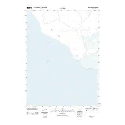
2011 Map of Rozel Point
USGS Topo · Published 2011About this map
Rozel Point projects into the northern waters of the Great Salt Lake, defining a stark geographical boundary where the lake divides into Rozel Bay and Gunnison Bay. This 2011 survey captures the remote coastline of Box Elder County, showing the vast transition from the elevated Rozel Hills down to the low-lying Rozel Flat. The terrain is characterized by its isolation and the shifting shoreline of the hypersaline lake. While the map is sparse of traditional settlements or infrastructure, it serves as a precise record of the shoreline and topographical contours during a period of modern hydrological monitoring. It provides a baseline for researchers and environmental historians studying the North Arm of the lake, where the unique chemistry and water levels create a landscape unlike any other in the Great Basin.
Find a feature on this map
6 named features on this map. Tap any name to fly to it.
Don’t see what you’re looking for? This feature index may not catch every label — zoom into the map to look around manually.
Map Details
Editions of this 2011 Rozel Point Map
This is the sole edition of this map. No revisions or reprints were ever made.
Other maps of this area

1954 · Brigham City
USGS Topo · 1:250,000

1958 · Brigham City
USGS Topo · 1:250,000

1962 · Brigham City
USGS Topo · 1:250,000

1967 · Golden Spike Monument
USGS Topo · 1:24,000

1968 · Messix Peak
USGS Topo · 1:24,000

1968 · Rozel
USGS Topo · 1:24,000

1968 · Coyote Point
USGS Topo · 1:24,000

1968 · Indian Cove
USGS Topo · 1:24,000

1968 · Rozel Point
USGS Topo · 1:24,000

1969 · Rozel Point SW
USGS Topo · 1:24,000