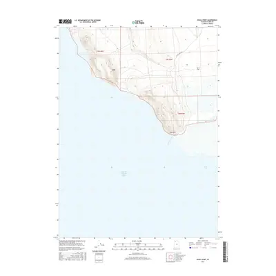
2017 Map of Rozel Point
USGS Topo · Published 2017About this map
Great Salt Lake dominates the southern half of this coastal survey, where the water meets the distinct peninsula of Rozel Point. This shoreline is defined by the elevation of the Rozel Hills, which rise sharply above the mudflats and brine. The landscape illustrates the isolation of the northern shore, where the only established infrastructure is the unpaved N Rozel Flats Rd W cutting through Rozel Flat. The map highlights the intersection of public land survey boundaries, including t9n r8w, t9n r7w, and t8n r7w, as they converge on this remote point of land overlooking Rozel Bay. It is a stark representation of the salt desert interface where high-country contours drop into the vast basin.
Find a feature on this map
9 named features on this map. Tap any name to fly to it.
Don’t see what you’re looking for? This feature index may not catch every label — zoom into the map to look around manually.
Map Details
Editions of this 2017 Rozel Point Map
This is the sole edition of this map. No revisions or reprints were ever made.
Other maps of this area

1954 · Brigham City
USGS Topo · 1:250,000

1958 · Brigham City
USGS Topo · 1:250,000

1962 · Brigham City
USGS Topo · 1:250,000

1967 · Golden Spike Monument
USGS Topo · 1:24,000

1968 · Messix Peak
USGS Topo · 1:24,000

1968 · Rozel
USGS Topo · 1:24,000

1968 · Coyote Point
USGS Topo · 1:24,000

1968 · Indian Cove
USGS Topo · 1:24,000

1968 · Rozel Point
USGS Topo · 1:24,000

1969 · Rozel Point SW
USGS Topo · 1:24,000