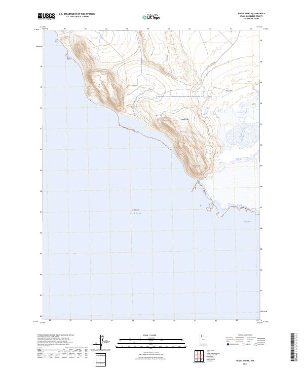
2023 Map of Rozel Point
USGS Topo · Published 2023About this map
Great Salt Lake dominates the southern half of this modern survey, where its waters meet the northern shoreline of Rozel Bay. The landscape is characterized by the prominent projection of Rozel Point, a distinctive peninsula that serves as a natural transition between the open lake and the protected bay waters. Inland, the topography rises into the Rozel Hills, which provide elevation above the adjacent Rozel Flat.
Find a feature on this map
6 named features on this map. Tap any name to fly to it.
Don’t see what you’re looking for? This feature index may not catch every label — zoom into the map to look around manually.
Map Details
Editions of this 2023 Rozel Point Map
This is the sole edition of this map. No revisions or reprints were ever made.
Other maps of this area

1954 · Brigham City
USGS Topo · 1:250,000

1958 · Brigham City
USGS Topo · 1:250,000

1962 · Brigham City
USGS Topo · 1:250,000

1967 · Golden Spike Monument
USGS Topo · 1:24,000

1968 · Messix Peak
USGS Topo · 1:24,000

1968 · Rozel
USGS Topo · 1:24,000

1968 · Coyote Point
USGS Topo · 1:24,000

1968 · Indian Cove
USGS Topo · 1:24,000

1968 · Rozel Point
USGS Topo · 1:24,000

1969 · Rozel Point SW
USGS Topo · 1:24,000