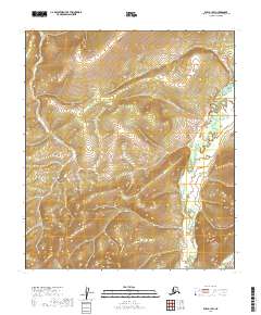
2019 Map of Ruby A-1 SW
USGS Topo · Published 2019About this map
Sethkokna River defines the low-lying eastern portion of this 2019 survey, winding through a series of tight oxbows and marshy basins. The remainder of the landscape is dominated by high, unnamed ridges that rise sharply from the river valley, reaching elevations marked by tight contour intervals across the township lines of t16s r27e, t16s r28e, and t17s r28e. This interior Alaskan terrain remains largely untracked by roads or modern development, showing the wilderness character of the Yukon-Koyukuk region as it appeared in the early 21st century.
Find a feature on this map
6 named features on this map. Tap any name to fly to it.
Don’t see what you’re looking for? This feature index may not catch every label — zoom into the map to look around manually.
Map Details
Editions of this 2019 Ruby A-1 SW Map
This is the sole edition of this map. No revisions or reprints were ever made.
Other maps of this area

1950 · Medfra
USGS Topo · 1:250,000

1951 · Ruby
USGS Topo · 1:250,000

1952 · Ruby A-2
USGS Topo · 1:63,360

1952 · Ruby A-1
USGS Topo · 1:63,360

1952 · Ruby
USGS Topo · 1:250,000

1958 · Medfra D-2
USGS Topo · 1:63,360

1958 · Medfra D-1
USGS Topo · 1:63,360

1959 · Medfra
USGS Topo · 1:250,000

1964 · Ruby
USGS Topo · 1:250,000
2019 · Ruby A-1 NE
USGS Topo · 1:25,000