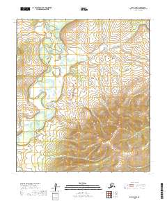
2019 Map of Ruby A-2 NW
USGS Topo · Published 2019About this map
Nowitna River dominates the western half of this interior landscape, carving a complex series of tight meanders and abandoned oxbows through the low-lying terrain. The river's winding path indicates a dynamic hydrologic environment where the channel shift over time is clearly visible in the topographical contours. To the east, the elevation rises sharply into a series of ridges and upland basins drained by Mastodon Cr, which flows north toward the river valley. In the southeastern corner, the headwaters of American Cr emerge from the high ground. The lack of named settlements or infrastructure highlights the isolation of this portion of the Yukon-Koyukuk Census Area, where the topography is defined entirely by natural drainages and significant elevation changes between the river basin and the surrounding hills.
Find a feature on this map
9 named features on this map. Tap any name to fly to it.
Don’t see what you’re looking for? This feature index may not catch every label — zoom into the map to look around manually.
Map Details
Editions of this 2019 Ruby A-2 NW Map
This is the sole edition of this map. No revisions or reprints were ever made.
Other maps of this area

1951 · Ruby
USGS Topo · 1:250,000

1952 · Ruby A-2
USGS Topo · 1:63,360

1952 · Ruby B-2
USGS Topo · 1:63,360

1952 · Ruby A-3
USGS Topo · 1:63,360

1952 · Ruby B-3
USGS Topo · 1:63,360

1952 · Ruby
USGS Topo · 1:250,000
1953 · Ruby B-3
USGS Topo · 1:63,360

1964 · Ruby
USGS Topo · 1:250,000
2019 · Ruby A-2 SE
USGS Topo · 1:25,000
2019 · Ruby A-2 NE
USGS Topo · 1:25,000