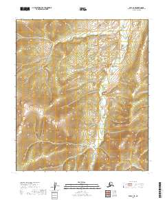
2019 Map of Ruby A-2 SE
USGS Topo · Published 2019About this map
Telsitna River meanders through this interior Alaska landscape, providing the primary drainage for the surrounding basins. This 2019 survey documents the intricate topography of the Yukon-Koyukuk Census Area, centered on the boundary between t16s r26e and t16s r27e. The map illustrates the complex drainage patterns of this subarctic environment, where the river valley cuts through elevations ranging from 700 to over 2,200 feet. The Public Land Survey System grid provides a structured overlay for this largely undeveloped terrain, including the transition into t17s r26e and t17s r27e.
Find a feature on this map
5 named features on this map. Tap any name to fly to it.
Don’t see what you’re looking for? This feature index may not catch every label — zoom into the map to look around manually.
Map Details
Editions of this 2019 Ruby A-2 SE Map
This is the sole edition of this map. No revisions or reprints were ever made.
Other maps of this area

1950 · Medfra
USGS Topo · 1:250,000

1951 · Ruby
USGS Topo · 1:250,000

1952 · Ruby A-2
USGS Topo · 1:63,360

1952 · Ruby A-1
USGS Topo · 1:63,360

1952 · Ruby
USGS Topo · 1:250,000

1958 · Medfra D-2
USGS Topo · 1:63,360

1958 · Medfra D-1
USGS Topo · 1:63,360

1959 · Medfra
USGS Topo · 1:250,000

1964 · Ruby
USGS Topo · 1:250,000
2019 · Medfra D-2 NE
USGS Topo · 1:25,000