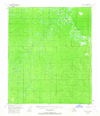
1953 Map of Ruby B-3
USGS Topo · Published 1967About this map
The Nowitna River meanders through the northeast corner of this Interior Alaska landscape, characterized by complex oxbows and marshy lowlands typical of the Yukon River drainage system. The terrain transitions from these low-lying riparian corridors into the elevated heights of the Monzonite Hills to the west. This 1950s survey, updated with minor revisions in the mid-1960s, documents a vast, unsurveyed wilderness where land lines were predetermined by the Bureau of Land Management rather than being physically marked on the ground. Waterways such as the Little Mud River and the meandering Lost River define the local drainage patterns, providing critical orientation markers in a region without established roads or permanent settlements at the time of the survey. The topography reveals a landscape of high-elevation points and extensive swampy bottoms, illustrating the physical barriers to overland travel in this part of the subarctic.
Find a feature on this map
4 named features on this map. Tap any name to fly to it.
Don’t see what you’re looking for? This feature index may not catch every label — zoom into the map to look around manually.
Map Details
Editions of this 1953 Ruby B-3 Map
2 editions found
Other maps of this area

1951 · Ruby
USGS Topo · 1:250,000

1952 · Ruby A-2
USGS Topo · 1:63,360

1952 · Ruby B-2
USGS Topo · 1:63,360

1952 · Ruby A-3
USGS Topo · 1:63,360

1952 · Ruby A-4
USGS Topo · 1:63,360

1952 · Ruby C-3
USGS Topo · 1:63,360

1952 · Ruby B-4
USGS Topo · 1:63,360

1952 · Ruby C-2
USGS Topo · 1:63,360

1952 · Ruby B-3
USGS Topo · 1:63,360

1952 · Ruby C-4
USGS Topo · 1:63,360