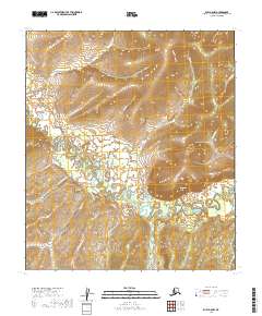
2019 Map of Ruby A-5 NW
USGS Topo · Published 2019About this map
Sulatna Crossing marks a rare point of human infrastructure in this remote stretch of the Alaska interior, situated where the Ruby-Poorman Road (Extension) intersects the meandering Sulatna River. The landscape is defined by the heavy winding of water through low-lying flats, flanked by elevated features like Sulatna Bluff and Tamarack Bluff. This 2019 survey documents a complex network of drainage basins, including Ophir Cr, Foley Cr, and Spangle Cr, which feed into the primary river system. The presence of the road extension highlights the ongoing significance of the Ruby-Poorman corridor, a vital link for mining and transit in the Yukon-Koyukuk Census Area. This map provides a clear record of the area's hydrology and the fragile reach of overland travel through the Alaskan wilderness.
Find a feature on this map
22 named features on this map. Tap any name to fly to it.
Don’t see what you’re looking for? This feature index may not catch every label — zoom into the map to look around manually.
Map Details
Editions of this 2019 Ruby A-5 NW Map
This is the sole edition of this map. No revisions or reprints were ever made.
Other maps of this area

1951 · Ruby
USGS Topo · 1:250,000

1952 · Ruby B-6
USGS Topo · 1:63,360

1952 · Ruby B-5
USGS Topo · 1:63,360

1952 · Ruby A-5
USGS Topo · 1:63,360

1952 · Ruby A-6
USGS Topo · 1:63,360

1952 · Ruby
USGS Topo · 1:250,000

1964 · Ruby
USGS Topo · 1:250,000
2019 · Ruby A-5 SW
USGS Topo · 1:25,000
2019 · Ruby A-6 SE
USGS Topo · 1:25,000
2019 · Ruby A-5 SE
USGS Topo · 1:25,000