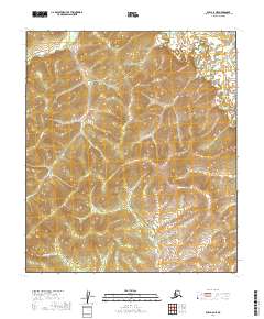
2019 Map of Ruby A-6 NE
USGS Topo · Published 2019About this map
The Sulatna River winds through the northeastern portion of this Yukon-Koyukuk interior landscape, where the terrain is defined by a dense network of gold-bearing creeks and steep gulches. Mapping provided by the U.S. Geological Survey reveals a wilderness shaped by drainage patterns, including the prominent flow of Gold Run and Sunday Cr. The naming conventions found here, such as Lucky Gulch and Fourth of July Cr, reflect the regional history of exploration and the seasonal rhythms of life along these northern tributaries. In the lower reaches, Schist Cr and Nevada Cr cut through the elevation, providing a clear view of the complex topography of the Ruby A-6 NE quadrangle as it appeared in the early 21st century. This area remains largely undeveloped, preserving a landscape where transport and movement followed the natural paths of the water and the ridges between them.
Find a feature on this map
17 named features on this map. Tap any name to fly to it.
Don’t see what you’re looking for? This feature index may not catch every label — zoom into the map to look around manually.
Map Details
Editions of this 2019 Ruby A-6 NE Map
This is the sole edition of this map. No revisions or reprints were ever made.
Other maps of this area

1951 · Ruby
USGS Topo · 1:250,000

1952 · Ruby B-6
USGS Topo · 1:63,360

1952 · Ruby B-5
USGS Topo · 1:63,360

1952 · Ruby A-5
USGS Topo · 1:63,360

1952 · Ruby A-6
USGS Topo · 1:63,360

1952 · Ruby
USGS Topo · 1:250,000

1964 · Ruby
USGS Topo · 1:250,000
2019 · Ruby A-5 SW
USGS Topo · 1:25,000
2019 · Ruby A-6 NW
USGS Topo · 1:25,000
2019 · Ruby A-6 SE
USGS Topo · 1:25,000