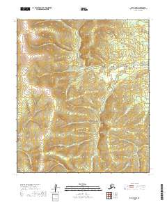
2019 Map of Ruby B-5 NW
USGS Topo · Published 2019About this map
Lucky Gulch and Glen Gulch are central features in this remote interior landscape of the Yukon-Koyukuk region. The area is defined by a dense network of watercourses, including the notable Easy Money Cr and Gold Run, names that evoke the prospecting history of the Alaskan wilderness. High-altitude drainages such as Bear Gulch and Snow Gulch feed into larger systems like Birch Cr. The map reveals a land structured by its relief and waterways rather than human infrastructure, as seen in the paths of Eldorado Cr and Dominion Cr. This topography highlights the isolation of the Long vicinity, where natural drainage patterns dictate the possible routes through the terrain. The presence of Elephant Cr and Fourth of July Cr further illustrates the localized naming conventions of the region's early explorers and miners.
Find a feature on this map
23 named features on this map. Tap any name to fly to it.
Don’t see what you’re looking for? This feature index may not catch every label — zoom into the map to look around manually.
Map Details
Editions of this 2019 Ruby B-5 NW Map
This is the sole edition of this map. No revisions or reprints were ever made.
Other maps of this area

1951 · Ruby
USGS Topo · 1:250,000

1952 · Ruby B-6
USGS Topo · 1:63,360

1952 · Ruby C-5
USGS Topo · 1:63,360

1952 · Ruby B-5
USGS Topo · 1:63,360

1952 · Ruby C-6
USGS Topo · 1:63,360

1952 · Ruby
USGS Topo · 1:250,000

1964 · Ruby
USGS Topo · 1:250,000
2019 · Ruby B-5 NE
USGS Topo · 1:25,000
2019 · Ruby C-5 SE
USGS Topo · 1:25,000
2019 · Ruby C-5 SW
USGS Topo · 1:25,000