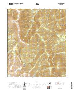
2019 Map of Ruby B-5 SW
USGS Topo · Published 2019About this map
The Ruby - Poorman Road provides the primary access through this remote portion of the Yukon-Koyukuk region, winding through a landscape defined by an intricate network of drainage systems. This 2019 survey documents a terrain where prominent geological features like Monument Rocks stand as landmarks for travelers and prospectors alike. The map is heavily marked by gold-bearing nomenclature, with Gold Cr, Ophir Cr, and Lucky Gulch suggesting a history of mineral exploration and seasonal mining activity. Numerous tributaries, including Fifth of July Cr and Greenstone Cr, carve through the elevations of the T13S and T14S townships, illustrating the complex hydrology that historically dictated movement and settlement patterns in the Alaska interior.
Find a feature on this map
23 named features on this map. Tap any name to fly to it.
Don’t see what you’re looking for? This feature index may not catch every label — zoom into the map to look around manually.
Map Details
Editions of this 2019 Ruby B-5 SW Map
This is the sole edition of this map. No revisions or reprints were ever made.
Other maps of this area

1951 · Ruby
USGS Topo · 1:250,000

1952 · Ruby B-6
USGS Topo · 1:63,360

1952 · Ruby B-5
USGS Topo · 1:63,360

1952 · Ruby A-5
USGS Topo · 1:63,360

1952 · Ruby A-6
USGS Topo · 1:63,360

1952 · Ruby
USGS Topo · 1:250,000

1964 · Ruby
USGS Topo · 1:250,000
2019 · Ruby B-5 NE
USGS Topo · 1:25,000
2019 · Ruby A-5 NW
USGS Topo · 1:25,000
2019 · Ruby B-6 NE
USGS Topo · 1:25,000