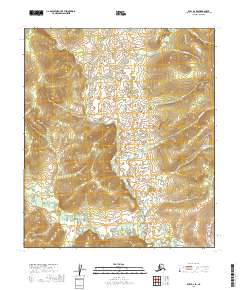
2019 Map of Ruby B-6 SE
USGS Topo · Published 2019About this map
The Ruby / Poorman Road carves through the eastern edge of this landscape, serving as a vital terrestrial link in a region dominated by the drainage systems of the Yukon-Koyukuk. The terrain is defined by a dense network of waterways including the Sulatna River and Greenstone Cr, which flow through the interior wilderness of Alaska.
Find a feature on this map
16 named features on this map. Tap any name to fly to it.
Don’t see what you’re looking for? This feature index may not catch every label — zoom into the map to look around manually.
Map Details
Editions of this 2019 Ruby B-6 SE Map
This is the sole edition of this map. No revisions or reprints were ever made.
Other maps of this area

1951 · Ruby
USGS Topo · 1:250,000

1952 · Ruby B-6
USGS Topo · 1:63,360

1952 · Ruby B-5
USGS Topo · 1:63,360

1952 · Ruby A-5
USGS Topo · 1:63,360

1952 · Ruby A-6
USGS Topo · 1:63,360

1952 · Ruby
USGS Topo · 1:250,000

1964 · Ruby
USGS Topo · 1:250,000
2019 · Ruby A-6 NW
USGS Topo · 1:25,000
2019 · Ruby A-5 NW
USGS Topo · 1:25,000
2019 · Ruby B-6 NE
USGS Topo · 1:25,000