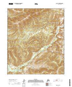
2019 Map of Ruby C-1 SE
USGS Topo · Published 2019About this map
Big Mud River winds through this interior Alaskan landscape, defining the primary drainage pattern of the region. The terrain is characterized by intricate contouring that reveals a complex system of ridges and valleys typical of the Yukon-Koyukuk Census Area. This 2019 survey documents the natural hydrography and elevation before any major industrial or modern development altered the course of the waterways. The map is primarily structured by the Public Land Survey System, showing the intersection of several townships including t10s r28e, t10s r29e, and t4s r27w. These administrative divisions provide the essential framework for land management in this sparsely named wilderness, where the river remains the most prominent geographical landmark for navigation and resource study.
Find a feature on this map
8 named features on this map. Tap any name to fly to it.
Don’t see what you’re looking for? This feature index may not catch every label — zoom into the map to look around manually.
Map Details
Editions of this 2019 Ruby C-1 SE Map
This is the sole edition of this map. No revisions or reprints were ever made.
Other maps of this area

1948 · Kantishna River
USGS Topo · 1:250,000

1951 · Kantishna River
USGS Topo · 1:250,000

1951 · Ruby
USGS Topo · 1:250,000

1952 · Ruby B-1
USGS Topo · 1:63,360

1952 · Ruby C-1
USGS Topo · 1:63,360

1952 · Kantishna River C-6
USGS Topo · 1:63,360

1952 · Kantishna River
USGS Topo · 1:250,000

1952 · Kantishna River B-6
USGS Topo · 1:63,360

1952 · Ruby
USGS Topo · 1:250,000

1964 · Kantishna River
USGS Topo · 1:250,000