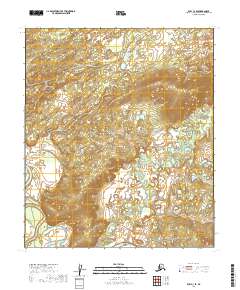
2019 Map of Ruby C-3 SE
USGS Topo · Published 2019About this map
The Nowitna River meanders through the southwestern corner of this interior Alaskan landscape, defining the local drainage patterns within the Yukon-Koyukuk region. To the east, the Little Mud River winds across the lowlands, its complex oxbows and shifting channels indicating a dynamic fluvial environment. The terrain is characterized by a high concentration of small lakes and marshy depressions scattered across the valley floors between rising ridges. This area is mapped across several township boundaries, including t10s r23e, t10s r24e, t11s r23e, and t11s r24e, reflecting the formal Public Land Survey System grid overlaying a largely untouched wilderness. The contour lines reveal a transition from the saturated river basins to more elevated, dissected uplands in the northern and central portions of the quadrangle.
Find a feature on this map
6 named features on this map. Tap any name to fly to it.
Don’t see what you’re looking for? This feature index may not catch every label — zoom into the map to look around manually.
Map Details
Editions of this 2019 Ruby C-3 SE Map
This is the sole edition of this map. No revisions or reprints were ever made.
Other maps of this area

1951 · Ruby
USGS Topo · 1:250,000

1952 · Ruby B-2
USGS Topo · 1:63,360

1952 · Ruby C-3
USGS Topo · 1:63,360

1952 · Ruby C-2
USGS Topo · 1:63,360

1952 · Ruby B-3
USGS Topo · 1:63,360

1952 · Ruby
USGS Topo · 1:250,000
1953 · Ruby B-3
USGS Topo · 1:63,360

1964 · Ruby
USGS Topo · 1:250,000
2019 · Ruby B-2 NW
USGS Topo · 1:25,000
2019 · Ruby C-2 NW
USGS Topo · 1:25,000