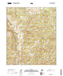
2019 Map of Ruby C-4 NW
USGS Topo · Published 2019About this map
Beaver Cr and Big Cr define the hydrological character of this interior Alaska wilderness in the Yukon-Koyukuk region. The landscape is marked by a complex network of wetlands and small lakes that indicate a terrain influenced by permafrost and shifting drainage patterns. This 2019 survey documents the natural state of the area, where the lack of roads or established settlements emphasizes the remote nature of the territory. The survey provides a clear view of the topography, where low-lying drainage basins are separated by subtle elevations, as seen through the intricate contour intervals and watercourses. Genealogists or historians interested in the historical surveying of the Alaskan interior will find the detailed township and range boundaries particularly useful for locating specific land allotments or exploring the untouched wilderness of the Ruby quadrangle.
Find a feature on this map
9 named features on this map. Tap any name to fly to it.
Don’t see what you’re looking for? This feature index may not catch every label — zoom into the map to look around manually.
Map Details
Editions of this 2019 Ruby C-4 NW Map
This is the sole edition of this map. No revisions or reprints were ever made.
Other maps of this area

1951 · Ruby
USGS Topo · 1:250,000

1952 · Ruby D-4
USGS Topo · 1:63,360

1952 · Ruby D-5
USGS Topo · 1:63,360

1952 · Ruby C-5
USGS Topo · 1:63,360

1952 · Ruby C-4
USGS Topo · 1:63,360

1952 · Ruby
USGS Topo · 1:250,000
1953 · Ruby D-4
USGS Topo · 1:63,360

1964 · Ruby
USGS Topo · 1:250,000
2019 · Ruby D-4 SE
USGS Topo · 1:25,000
2019 · Ruby D-4 SW
USGS Topo · 1:25,000