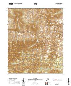
2019 Map of Ruby D-1 NE
USGS Topo · Published 2019About this map
Blind River winds through this interior Alaskan wilderness, serving as the central geographic feature of a landscape defined by its remote hydrology and complex topographic relief. Located within the Yukon-Koyukuk Census Area, the map illustrates the intricate drainage patterns where small tributaries and seasonal waterways feed into the main river channel. The absence of roads or permanent structures reflects the traditional character of this subarctic environment, where the land is primarily organized by the Public Land Survey System. The township and range lines, such as t6s r28e and t7s r29e, provide the only formal human-imposed grid over the winding river valley and surrounding upland elevations.
Find a feature on this map
7 named features on this map. Tap any name to fly to it.
Don’t see what you’re looking for? This feature index may not catch every label — zoom into the map to look around manually.
Map Details
Editions of this 2019 Ruby D-1 NE Map
This is the sole edition of this map. No revisions or reprints were ever made.
Other maps of this area

1948 · Kantishna River
USGS Topo · 1:250,000

1951 · Kantishna River
USGS Topo · 1:250,000

1951 · Ruby
USGS Topo · 1:250,000

1951 · Melozitna
USGS Topo · 1:250,000

1951 · Tanana
USGS Topo · 1:250,000

1952 · Ruby D-1
USGS Topo · 1:63,360

1952 · Kantishna River
USGS Topo · 1:250,000

1952 · Tanana A-6
USGS Topo · 1:63,360

1952 · Kantishna River D-6
USGS Topo · 1:63,360

1952 · Ruby
USGS Topo · 1:250,000