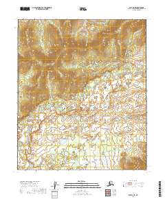
2019 Map of Ruby D-2 SE
USGS Topo · Published 2019About this map
The winding course of the Little Mud River dominates this interior Alaska landscape, weaving through a complex network of wetlands and low-lying drainages. Surveyed in 2019, the terrain illustrates the intricate hydrology of the Yukon-Koyukuk region, where the river's path is marked by numerous small oxbows and stagnant pools. This topographic study captures the area's transition from the elevated ridges of t7s r25e and t7s r26e down to the saturated basins of t8s r25e and t8s r26e. The lack of established roads or settlements highlights the isolation of this portion of the Ruby D-2 SE quadrangle, where the natural water systems remain the primary geographic features defining the land.
Find a feature on this map
5 named features on this map. Tap any name to fly to it.
Don’t see what you’re looking for? This feature index may not catch every label — zoom into the map to look around manually.
Map Details
Editions of this 2019 Ruby D-2 SE Map
This is the sole edition of this map. No revisions or reprints were ever made.
Other maps of this area

1951 · Ruby
USGS Topo · 1:250,000

1952 · Ruby C-1
USGS Topo · 1:63,360

1952 · Ruby D-1
USGS Topo · 1:63,360

1952 · Ruby C-2
USGS Topo · 1:63,360

1952 · Ruby D-2
USGS Topo · 1:63,360

1952 · Ruby
USGS Topo · 1:250,000

1964 · Ruby
USGS Topo · 1:250,000
2019 · Ruby D-2 NE
USGS Topo · 1:25,000
2019 · Ruby D-1 SW
USGS Topo · 1:25,000
2019 · Ruby D-2 NW
USGS Topo · 1:25,000