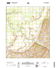
2019 Map of Ruby D-2 NW
USGS Topo · Published 2019About this map
Bering Cr winds through this expanse of the Yukon-Koyukuk Census Area, tracing a complex path across a landscape defined by its riparian drainage patterns. This 2019 survey, based on hydrography data spanning back to 1899, illustrates the persistent natural watercourse within the public land survey divisions of t6s r24e, t6s r25e, t7s r24e, and t7s r25e. The map reveals the gradual transition from the low-lying wetlands surrounding the creek to the rising elevation shown in the southeastern quadrant.
Find a feature on this map
5 named features on this map. Tap any name to fly to it.
Don’t see what you’re looking for? This feature index may not catch every label — zoom into the map to look around manually.
Map Details
Editions of this 2019 Ruby D-2 NW Map
This is the sole edition of this map. No revisions or reprints were ever made.
Other maps of this area

1951 · Ruby
USGS Topo · 1:250,000

1951 · Melozitna
USGS Topo · 1:250,000

1952 · Melozitna A-2
USGS Topo · 1:63,360

1952 · Ruby D-3
USGS Topo · 1:63,360

1952 · Ruby D-2
USGS Topo · 1:63,360

1952 · Ruby
USGS Topo · 1:250,000

1953 · Melozitna A-2
USGS Topo · 1:63,360
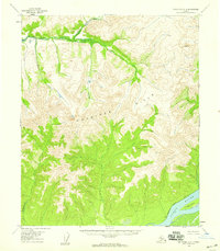
1954 · Melozitna A-3
USGS Topo · 1:63,360

1956 · Melozitna
USGS Topo · 1:250,000

1964 · Ruby
USGS Topo · 1:250,000