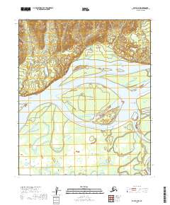
2019 Map of Ruby D-3 NW
USGS Topo · Published 2019About this map
The Yukon River dominates this interior landscape, carving a complex network of channels and braided streams through the Yukon-Koyukuk region. The main waterway is subdivided into the Yukon River Main Channel, Western Channel, and East Channel, creating a series of large, named landmasses including Florence Island, Edith Island, and Novakaket Island. The confluence with the Nowitna River in the southeast corner further complicates the aquatic geography, where river dynamics are recorded at specific landmarks like Mouse Point and Cross Point. This 2019 survey documents a wilderness environment shaped by seasonal water movement, where seasonal sloughs such as Victor Slough and Novakaket Slough weave between the larger riverbanks. The terrain is characterized by the expansive Big Bend of the Yukon and the drainage of smaller tributaries like Ukawutni Cr and Junekaket Creek.
Find a feature on this map
22 named features on this map. Tap any name to fly to it.
Don’t see what you’re looking for? This feature index may not catch every label — zoom into the map to look around manually.
Map Details
Editions of this 2019 Ruby D-3 NW Map
This is the sole edition of this map. No revisions or reprints were ever made.
Other maps of this area

1951 · Ruby
USGS Topo · 1:250,000

1951 · Melozitna
USGS Topo · 1:250,000

1952 · Ruby D-4
USGS Topo · 1:63,360

1952 · Ruby D-3
USGS Topo · 1:63,360

1952 · Ruby
USGS Topo · 1:250,000

1953 · Melozitna A-4
USGS Topo · 1:63,360
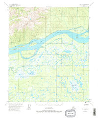
1953 · Ruby D-4
USGS Topo · 1:63,360
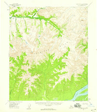
1954 · Melozitna A-3
USGS Topo · 1:63,360

1956 · Melozitna
USGS Topo · 1:250,000

1964 · Ruby
USGS Topo · 1:250,000