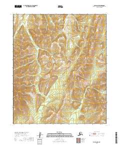
2019 Map of Ruby D-6 NW
USGS Topo · Published 2019About this map
The interior landscape of the Yukon-Koyukuk Census Area is meticulously documented in this 2018 elevation dataset, illustrating a terrain defined by high ridges and drainage basins. Organized around the convergence of T6s R14e, T6s R15e, T7s R14e, and T7s R15e, the map reveals a wilderness without named settlements or infrastructure. The topography is dominated by steep relief, with peaks reaching above 2000 feet in several sectors. This specific quadrangle serves as a baseline for understanding the geomorphology of the Ruby region, where the lack of human-made labels suggests a landscape largely untouched by permanent development or industrial footprints at the time of the imagery capture.
Find a feature on this map
4 named features on this map. Tap any name to fly to it.
Don’t see what you’re looking for? This feature index may not catch every label — zoom into the map to look around manually.
Map Details
Editions of this 2019 Ruby D-6 NW Map
This is the sole edition of this map. No revisions or reprints were ever made.
Other maps of this area

1945 · Nulato
USGS Topo · 1:250,000

1951 · Nulato
USGS Topo · 1:250,000

1951 · Ruby
USGS Topo · 1:250,000

1951 · Kateel River
USGS Topo · 1:250,000

1951 · Melozitna
USGS Topo · 1:250,000

1952 · Nulato D-1
USGS Topo · 1:63,360

1952 · Ruby D-6
USGS Topo · 1:63,360

1952 · Kateel River A-1
USGS Topo · 1:63,360

1952 · Nulato
USGS Topo · 1:250,000
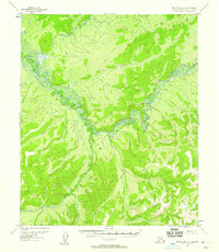
1952 · Melozitna A-6
USGS Topo · 1:63,360